
Services
PARSAN offers a range of geophysical and geodetic services for various service segments, including:
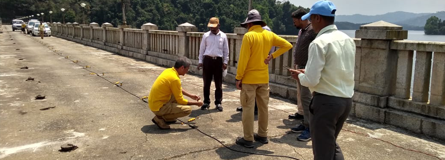
Engineering Geophysics
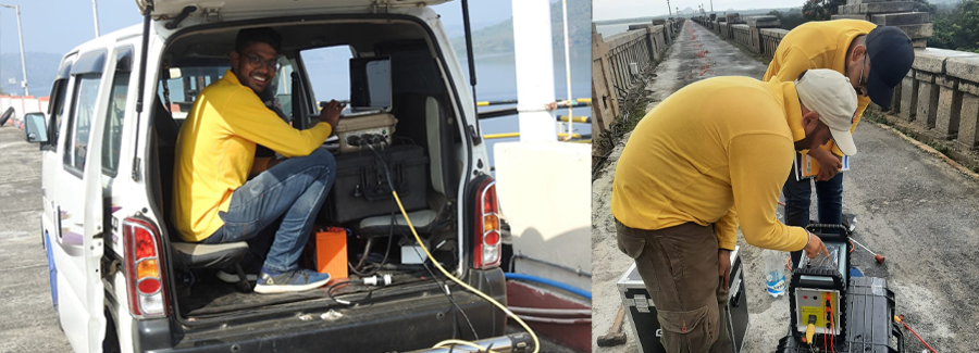
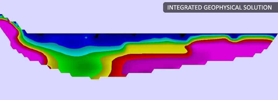
For foundation studies (bedrock topography, overburden mapping, earthquake response studies), cavity detection, tunnel route studies etc. Our expertise include detailed investigations for hydropower, thermal power, nuclear power projects, bridges, high-rise buildings and other heavy structures. Expertise of PARSAN includes investigations across flowing rivers to determine bedrock depth, thickness of overburden etc.
Read More >>Geophysical Data Processing And Interpretation Services
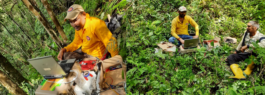
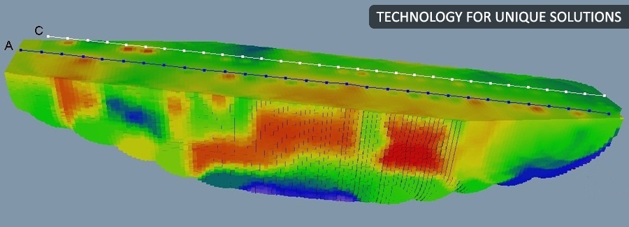
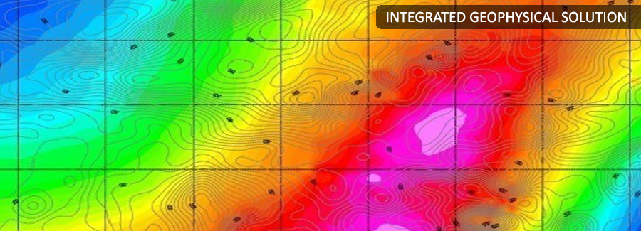
PARSAN provides full range of geophysical data processing and interpretation services using latest geophysical data processing software. With its pool of experienced geophysicists and geologists having years of experience in the field, we can free you from the costs and effort involved in back-end processing. The results can be provided on real time basis expediting final report generation.
Read More >>Airborne Geophysics
Parsan in association with SkyTEM Surveys ApS of Denmark is provider of airborne geophysical surveys offering the acquisition and advanced processing of transient electromagnetic (TEM), magnetic and radiometric data.
Read More >>Geophysics for Dam Safety
For Leakage path detection, Sink Hole Mapping, Concrete degradation, determination, Pre & post-grouting monitoring etc.
Read More >>Mining Geophysics
Ore body mapping, Rippability/ excavability studies, Slope stability studies, Vibration Monitoring, Ground water studies etc.
Read More >>Archaeological Geophysics
We have an entire range of engineering geophysical techniques to map buried archaeology rapidly and with minimal disturbance to the surface.
Read More >>Geophysics for Tunnelling
Most of the time, while working on tunnels, caverns and other underground projects, decision makers are working with limited and imperfect information.
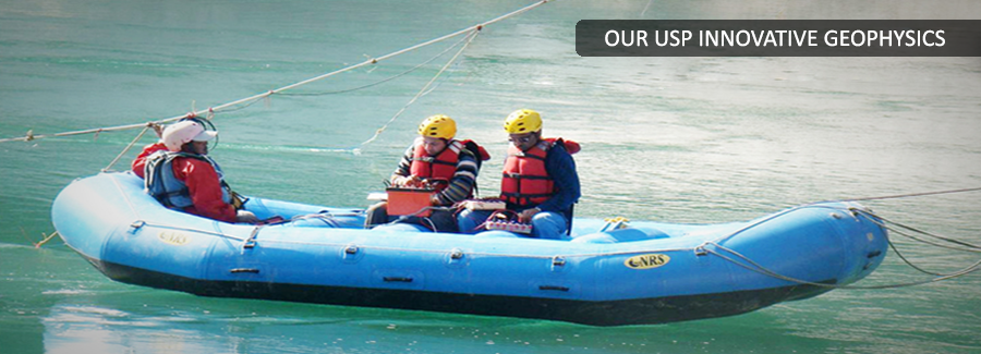
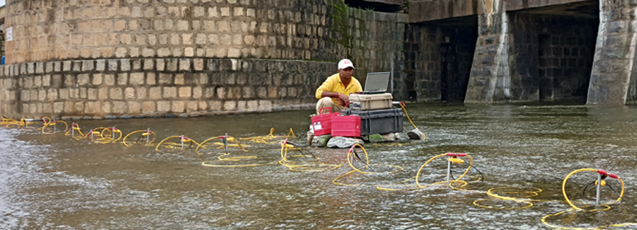
Read More >>Geophysical Surveys Across River
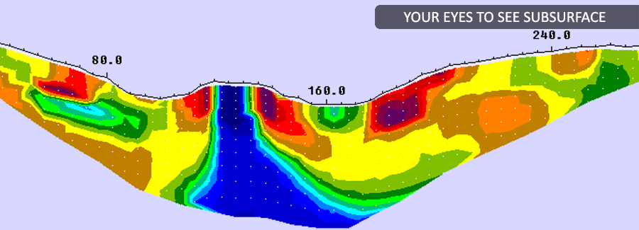
Subsurface information across river may be obtained through trench less technology. Geophysical techniques like seismic refraction, electrical resistivity tomography etc., can quickly provide the information across river crossings.
Read More >>Geophysics - Water Resources
Ground water Prospecting & Modeling, Contamination Studies, Landfill studies, Reservoir Sedimentation Studies etc.
Read More >>Environmental Geophysics
Locating USTs and drums, Landfill characterisation, Mapping contamination plumes and saline intrusions, Mapping migration pathways and groundwater movement, Mapping buried foundations, basements, and buried services, Surveying for shallow abandoned mine-workings etc.
Read More >>Passive Seismic Tomography
PARSAN in association with Seismotech Geophysical Solutions Ltd. of Greece is provider of Passive Seismic Tomography, which is a new revolutionary geophysical exploration technique which uses the natural seismicity (microearthquakes) as seismic sources and a portable seismological network as receivers in order to perform a detailed 3-D seismic velocity and Poisson ratio model of the upper few Km of the crust.
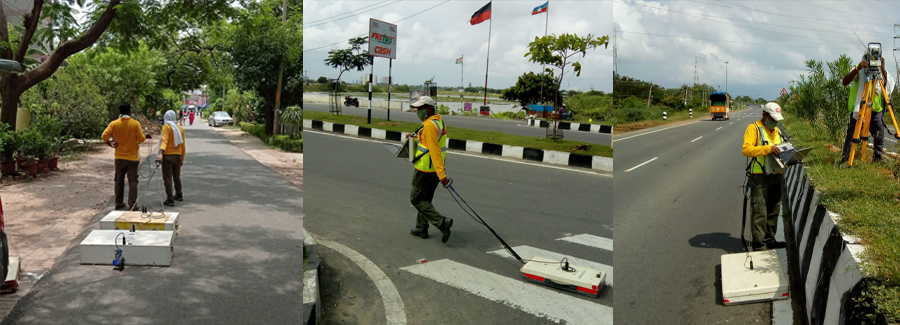
Read More >>Roads & Highway Inspection
Road Condition Evaluation, Subsurface settlement studies, precise determination of thickness of various layers, Quality control & vigilance etc.
Read More >>Utility Detection & Mapping
PARSAN has the privilege of being the first company in India to introduce the concept of Subsurface Utility Engineering (SUE) in large scale projects. Company works extensively on utility mapping projects using techniques like Ground Penetrating Radar, Induction Locators, Magnetic & Electromagnetic methods etc.
Read More >>Concrete Inspection
Assessment of mechanical strength of concrete structures, detection of flaws like honey-combing & voids, detection of conduits and reinforcement etc.
Read More >>Pipeline Leak Detection
PARSAN specialized in using geophysical tools like ground penetrating radar and geophones to detect pipeline leakages in difficult conditions where conventional methods like Leak noise correlator etc.
Read More >>Cavity Detection
Underground cavities pose threat for structures, and are critical to be detected and mapped. PARSAN has all the required tools and techniques available for accurate detection of underground natural or manmade cavities.
Read More >>Defence & Law Enforcement
PARSAN has entire range of geophysical tools for detection of land mines, underground hidden tunnels, graves, hidden buried arms & ammunition, buried bodies, crevasses in snow clad regions etc.
Read More >>Geodetic Services
PARSAN is providing an entire range of services in the field of topographic and hydrographic surveys. The surveys are carried out using latest instruments like DGPS, Total Stations, Autolevels, Digital echosounders etc.
Read More >>